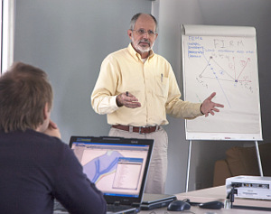
Prof Reinaldo Garcia from Hydronia, LLC and WaterSCAPES NASA Research Center, Florida International University, USA presented a short course entitled ‘Practical Two-Dimensional Hydraulic. Sediment and Pollutant Transport’.
Over a period of three days, lectures were presented on the following topics.
- Introduction, review training objectives, and course agenda.
- Overview of basics of two-dimensional hydraulics: Hydrodynamics, equations, boundary conditions and numerical methods. Assumptions and limitations.
- Introduction to Argus ONE: RiverFLO-2D v3Graphical User Interface. Layer types, mesh
generation options. Data interpolation options. - Setting up a RiverFLO-2D v3 project application. Importing elevation points, defining the model boundary, entering boundary conditions, refining the mesh, running the model.
- Data review and preparation of a selected Project. Data file format requirements. Guidelines for reviewing data and modelling results.
- Working with Mega-data projects. Handling billions of elevation points and huge data files.
- Creating and running a new RiverFLO-2D v3 project using real-world data.
- Creating and running a new RiverFLO-2D v3 project.
- Plotting RiverFLO-2D v3 results: Water Surface Elevations, Velocity Vector Plots, etc.
- Creating animations and exporting shape files: velocity fields, depths, water surface elevations.RiverFLO-2D v3 input and output files.
- Using cross section and profile outputs for model calibration. Comparing model results from different scenarios using layer operations.
- Overview of RiverFLO-2D v3 Components: Culverts, Bridge Piers, Internal Rating Tables, Weirs.
- Using Argus ONE to incorporate bridges, levees and other details in a RiverFLO-2D v3 simulation.
- Modelling pollutant transport.
- Develop a simple project – Part 1.
- Develop a simple project – Part 2.
- Introduction to modelling sediment transport in rivers.
- Modelling sediment transport in RiverFLO-2D v3
- Setting up a sediment transport simulation in RiverFLO-2D v3. Plot erosion and deposition. Extracting cross section and profiles. Creating profile animations including bed elevation changes.
- Develop a complex project – Part 1.
- Develop a complex project – Part 2.
Two-dimensional modelling of rivers and other water bodies is becoming essential practice in many river and coastal flooding, river restoration and pollutant transport studies. Mastering models to simulate such processes is crucial to tackle these demanding projects.
RiverFLO-2D is one of the most advanced hydrodynamic, and mobile bed finite element models for rivers, estuaries and coastal areas. It can handle subcritical and supercritical flows allowing fast and stable simulations of flooding, hydraulics of steep rivers, dam-break floods and sediment transport. This course provided the basic knowledge and software tools necessary to use the RiverFLO-2D river dynamics model in a variety of applications ranging from river flooding, sediment transport with bed erosion and deposition and pollutant transport.
The course presented the basic theory needed to understand the model functionality and guide participants through the process of practical modelling hands-on exercises using RiverFLO-2D v3 model. The participants learnt how to import topographic and bathymetric data in several file formats, manage the data using layers, creating high quality finite element meshes using the state-of-the art mesh generation engine, and generating plots from model results, including maps of temporal data such as velocity fields, depths, water levels, etc.
The course covered conceptual aspects, and practical hand-on sessions.
Each participant, as well as receiving the comprehensive course notes, also received a copy of the CD containing the RiverFLO-2D LT software (2000 element limit)

 Wessex Institute